Monday, October 30, 2006

City of Angles (Oct. 29)

We left our hot springs campground and quickly found ourselves in the longest line of RVs that we have ever seen. As far as the eye could see, before us and behind us, there were motor homes, trucks pulling trailers and pop-up campers. Almost all of them had four-wheelers or dune buggies on a trailer or in tow. It was slow going.

Then while scouting the map for the best way to navigate the web of L.A. freeways, we came to a standstill. And we were still 70 miles from L.A. proper! We sat in four lanes of traffic for close to an hour with the rest of the weekend-getaway traffic returning to the city for the work week ahead.

We met a good friend of Andrew's from Hope College, Noel Snyder and his wife, Heidi, in Pasadena. The college buddies met each others' wife for the first time (they met each other for the first time too). We had a great time with them, walking through Fuller Seminary where Noel studies, having an Italian family-style dinner at Buca di Beppo and catching up on the years since we'd left Hope and been married. We found this Harvest Festival in place on campus and took advantage of the photo opp. Noel and Heidi: Thank you for spending so much time with us! We will miss you guys.

Death Valley (Oct. 27 & 28)

Here we are at the lowest point in the western hemisphere, the Badwater Basin at 282 feet below sea level. (Telescope Peak is in the background, rising to 11,049 ft.) We found we could breathe really well with the extra air pressure… The ground is a salt pan, though it looks like snow from a distance. Too bad it comes with us on our shoes! Death Valley would be 9,000 ft deeper if all the rocks, gravel and sediment “fill” was removed. Again, we prayed for no earthquakes on the “loose” terrain.

Our favorite places in Death Valley National Park were:

Artists Palette: The multi-colored sediment layers throughout the park are fascinating. Coming upon all the colors of the rainbow in volcanic ash was breath-taking.


Dantes View: After climbing a road with a 15% grade finale, we had the best view of the Death Valley. You can see the white Badwater Basin below.


Mosaic Canyon: Naturally occurring marble is all over the place! You can feel it, walk on it, even slide down it. At points, one wall is marble and the other is a sedimentary rock. Very cool.


Ubehebe Crater: Spectacular striations. Thinking about falling in this 3,000 year old, 600 ft deep crater gave us the hebe-jebies…

Tecopa Hot Springs (Oct. 26 & 27)

Today we drove to the Tecopa Hot Springs Park. Before leaving Visalia, we shopped at a Save Mart. What surprised me was that there were only 7 check-out lanes for the entire supermarket, and it was a full-size, full-service store. Maybe things are bigger in Texas. We had lunch at Bakers Square which has the best pies on the market. Andrew ate too much. We have driven through most of the San Joaquin Valley and have seen the cultivation of numerous crops. Today we crossed the Mojave Desert, and at one point saw a bunch of parked, commercial airplanes!

All the water at the campground is hot, which is nice when you wake up in the morning and not so nice when you want a cold shower after being in the hot spring. The hot springs do have a rule: birthday suits only...

We also had a crazy neighbor who chose to set up his tent (with three dogs) BETWEEN our car and our tent. And we were the only tenters in the campground!


In-N-Out count: 3 There is a Bible verse printed on the bottom, inside rim of the cups. Any ideas on why?

Thursday, October 26, 2006

Sequoia & Kings Canyon (Oct. 24 & 25)

Sequoia & Kings Canyon National Parks

Largest Living Thing On Earth

And we saw it! It's the General Sherman tree, a giant sequoia. It's not that pretty to look at, but then again, neither would you be after 2,200 years! Incredible to think that it was living before Christ came to earth. It has the mass of four fully-loaded jumbo jets. This is a limb that fell less than a year ago. One gentleman remarked that maybe aliens came and planted these giant sequoias. That's California for you...

Andrew's favorite part of the park was the Four Guardsmen at the entrance to Giant Forest. Kings Canyon afforded us nice views as we drove in along the river and a walk around Zumwalt Meadow on which we stumbled upon three deer that bolted into the brush! After three national parks in the Sierra Nevada range, we are ready for something new.

We stayed at the Visalia KOA. We opted for clean facilities and WiFi with a higher price and longer drive time to the parks. It was worth it! We have managed to keep current with our favorite TV show, LOST, and are 4 for 4 in watching the episodes live. While on the road, we have been listening to the RELEVANT podcast. Check it out.

In-N-Out count: 2

Monday, October 23, 2006

Mercy in Merced

We have found that traveling works better when we take a day to catch-up and rest once a week. So we found a Travelodge in Merced, CA where we could check-in early and check-out late.

We went to the Laundromat with our clothes. We read poolside in mid-eighties sunshine. We holed up in the room and ordered pizza while watching NUMB3RS episodes on cbs.com (the innertube player was rather annoying). We checked email, updated the blog and made a few phone calls. We even went for a run/walk in the morning in the brisk air. We also bought groceries and washed the vehicle.

Milestone: Jen's first visit to an In-N-Out. For those of you not familiar with this fine Californian establishment, let me tell you that itÂ’s some of the best fast food out there. The three previous times that I (Andrew) have come to California, I have eaten my first meal at In-N-Out. They have the simplest menu in the industry: hamburger, cheeseburger, double cheeseburger, French fries, sodas and milkshakes. Their ingredients are as fresh as can be. We WATCHED them dice potatoes, fry them, salt them and serve them to us. We had been looking for In-N-Out for the past week since entering the state. What joy!

Since the drive to our next campground was short and the weather was warm again, we went to the movies! We saw The Prestige (trailer here), which fascinated us and we heartily recommend. We couldn'’t keep the characters/actors straight so we called them by their other, famous roles: Batman and Wolverine.

Yosemite (Oct. 21)

We awoke to a cold cabin. Apparently, the space heater has a timer on it that we cannot figure out. We stayed at Yosemite Westlake Campground & RV Park last night and tonight.

Today'’s agenda was Yosemite National Park. We learned that Sierra Nevada range, which passes through Yosemite, is one long piece of granite, spanning 400 miles.

The fall leaves in their colorful splendor made for a nice drive into the Yosemite Valley, which is the heart of the park. We now know how to spot a Ponderosa Pine. Our favorite spot was Bridalveil Falls where the water falls freely, landing on the rock several hundred feet below. Above the falls, comparatively little water flows so as it falls, it fans out at the mercy of the wind and chance giving the appearance of a thin, misty bridal veil.

Yosemite was the busiest national park of the seven we have visited thus far. Of course, it is within a day's drive of San Fransciso and other major California cities. Today is Saturday, and was a nice day with a high in the mid-seventies. Still, it felt touristy and congested. We enjoyed hearing numerous different languages throughout the day.

Milestone: the Vue turned 10,000 miles inside the park, after 3 months and 3 weeks in our care.

San Francisco (Oct. 20)

Today was long. We followed the Shoreline Highway (CA-1) into the Bay Area, crossed the Golden Gate Bridge (for $5 dollars), got lost in San Francisco, toured San Francisco as we found our way again, crossed the Bay Bridge (while praying for no earthquakes), and thought we beat the Friday afternoon rush hour traffic. We were stopped in traffic near Tracy which afforded us time to talk on cell phones to those of you who answered them!


We knew we were in San Francisco when we saw this:


A few observations about California:

1. Long live the Toyota Prius! It seems 1 out of every 20 cars here is a hybrid.

2. Hippies abound. If youÂ’re finding yourself craving some hippy companionship, buy an old VW mini-bus and head for the Pacific.

3. Chinese Camp, population 150, is located on CA-120 west of Yosemite. We in no way endorse this name for a any town.

4. We appreciate the “End 35 mph Speed Limit” signs. Can you post the new speed limit too???

Redwood Highway (Oct. 19)

Today was a turning point. Andrew lessened his grip on making plans. We left in the late morning and drove a reasonably short day, enjoying the time. We started south on the Redwood Highway (US-101) along the coast. We stopped for the Pizza Hut lunch buffet and somehow avoided the gut rot that normally follows. When the Shoreline Highway (CA-1) split off, we took it, and were surprised by the steepness of the inclines and sharpness of the curves. We stayed at Fort Bragg at the Pomo R.V. Park and had a roaring campfire.

Wednesday, October 18, 2006

Redwood: My Neck Hurts


Andrew didn't feel so tall today. Nobody commented on how tall he is. That's because we were in Redwood National Park where the trees can grow to over 300 ft! This is a picture of Big Tree, that is 21 ft wide; it's not even the tallest tree in the park. We spent a lot of time looking up today, and our necks are a bit sore.

The afternoon was a lot of fun. The Vue crossed its first creek. We saw our first wolf of the Road Trip. We came within 30 yards of a bull elk on the beach with the Pacific in view. We drove out to Fern Canyon and explored our way across a few home-made log crossings. Only one of us got wet. The air was a lot colder in the canyon with ferns and moss growing on the walls.

We spent last night and tonight at the Camper Corral in Kalmath, CA. A fine campground with friendly staff. Oh, and we had our first campfire tonight. It's all about the wood; dry cedar works wonders. We had SMORES for dessert.

Tuesday, October 17, 2006

US-101 Pacific Coast

After the relaxing days with Aunt Louise, we felt refreshed and ready to resume our road trip. Ironic that yesterday's nationwide high was 94* F in McAllen, TX - our former residence!

We made our way to the Oregon coast as quickly as possible and followed US-101 south along the Pacific Coast Scenic Byway. There were beautiful vistas from oceanside cliffs as well as from the beach all day long. The road meandered with the coastline, occasionally taking us through cool forests. Massive rocks in the ocean were easily visible from the shore. We also noticed lots of hitchhikers in Oregon.

At 9,234 mi on the odometer, we had an incident. First Roadkill. Andrew hit a squirrel as he was coming out of a curve high somewhere near Humburg Mt. He was hit twice, by the front and rear tires. Though he ran slow in life, his death was quick.

Rest @ Aunt Louise's (Oct. 15 & 16)

We awoke in a warm bed in Oregon City at 8:30. It felt great to sleep in, and things just kept getting better from there. We had a warm breakfast of poached eggs, hashbrowns, and waffles. I think Aunt Louise (Jen's Great Aunt) was as excited to have guests as we were to be her guests!

We put on our church clothes and joined her at the New Life Foursquare Church in Canby OR. It was nice to see her in her "natural habitat". We also brought her into our habitat a bit by introducing her to the T.V. show NUMB3RS. Over our two full days there, we watched 6 episodes! Other than that, we were somewhat productive and highly restful. Andrew got an oil change and a car wash while Jen took a nap. Later, Jen did laundry for her contribution. It was a very nice break from travel, and Aunt Louise was excellent at encouraging us to rest. Thank you!!!

Saturday, October 14, 2006

Idaho & Oregon I-84

This was a day of driving. Quality time on I-84.

We both made our first appearance in The Gem State: Idaho. Our first purchase there was a dozen chocolate-covered donuts at Wal Mart. No Krispy Kreme or Dunkin' Donuts in sight. Yes, we also bought milk to go with them.

Passing Oregon Trail markers along the road, seeing the open plains and passing through the Dalles reminded us of our first computer game: The Oregon Trail. Remember how you could hunt for meat, using the mouse as the scope?

The best view of the day was heading west along the Columbia River between the Dalles and Portland. Unfortunately, this happened at night. The downhill sharp curves at high speeds made it feel like playing a video game. We did have a great view of Mt. St. Helens in front of the setting sun.

Like Mexico, Oregon is full-service at the pump, all the time. They must not think it safe for us to pump our own gas.

Friday, October 13, 2006

Yellowstone 3 (Oct. 13)

Today's path took us down the east side of Yellowstone. Again, the highlights:

Grand Canyon of the Yellowstone (River) from Artist Point - there are seemingly too many viewing points of the lower falls and the canyon itself. We must admit, however, that it is impressive that a waterfall twice the height of Niagara Falls looks small between the massive canyon walls. Now we know why the river and park are called Yellowstone! This photo is from about as far from the falls as you can be and affords the best view.

Sulphur Caldron - this was Jen's favorite spot today. The acidity of this spring is close to that of car battery acid or stomach fluid. If you fell in, you would die a painful death. It was incredibly stinky to watch the bubbling and gurgling of this huge acidic spring. Nobody fell in, as far as we can tell...

Churning Caldron - across the road from Sulphur Caldron is Andrew's favorite spot of the day. This pool is frothing almost constantly! The sight and sound of it are amazing. The water is always in motion, sometimes it throws water upwards of 5 ft into the air. There was another formation in the area, Dragon's Mouth Spring, that really sounded like a dragon huffing and puffing, but we left out the picture as it just doesn't carry the same weight without audio (and we haven't figured out how to add our own videos to the blog yet).

Thursday, October 12, 2006

Yellowstone West Side (Oct. 12)

Today we drove up the west side of Yellowstone, from Old Faithful and the Upper Geyser Basin to Mammoth Hot Springs Terraces. We made many stops and took many photos. Here are our favorites.

Riverside Geyser - a predictable geyser in the Upper Geyser Basin that is "one of the most picturesque in the park" according to the trail guide. After watching Old Faithful, we power walked down the hill to this geyser, which erupts over the Firehole River. Sitting on the riverbank, this geyser has a unique position.

Fountain Geyser - an unpredictable geyser near Fountain Paint Pot that is "one of the most impressive geysers in the park" according to the trail guide. We like it because it really looks like a city fountain. Eruptions reached up to 50 ft. We had to pull away after watching for 15 minutes.
Palette Spring in the Mammoth Hot Springs Lower Terrace - the most stunning formation in this area of the park. Orange and brown hues cover the area. The large, flat terraces seem out of place and unnatural among the "waterfalls" that are round and curvy. This spring is alive and growing.

Yellowstone Bison (Oct. 11)

We said goodbye to Jackson Hole this morning and made another pass by the Tetons on Teton Park Road. We were hoping for a little clearer weather; there were still some clouds hanging around the peaks. We took a closer look at Grand Teton (Teton Glacier) and Mount Moran (Falling Ice Glacier & the Black Dike). We also looked for more moose...to no avail.

It's not far from Grand Teton to the most famous of America's National Parks, Yellowstone. It is, after all, the first national park in the world, established in 1872. We entered at the South Entrance, unprepared for the massiveness of the park. With a speed limit of 45mph, you are not going anywhere in a hurry. With frequent animal crossings, that's a good thing.

We could easily see the damage of the 1988 fires that affected much of Yellowstone. It was amazing to read that fire can "jump" enormous river valleys, as happened along the Lewis River. Charred, dead lodgepole pine trunks are still standing, almost twenty years later. We were encouraged to see all of the young trees bred by the fires all over the place.

We crossed the Continental Divide three times. Driving with the window open, watching the elk and bison, and trying to comprehend the magnitude of Yellowstone was enough for our first day. We learned that 640,000 years ago, the "hot spot" left a caldera (collapsed crater) 45 miles by 30 miles. Unbelievable!

Dinner was a bison burger for Jen and an elk burger for Andrew at Bullwinkle's. We didn't see moose on the menu.

We stayed the night in West Yellowstone, MT at the Best Western Weston Inn.

Wednesday, October 11, 2006

Grand Teton (Oct. 10)

We visited Grand Teton National Park today. Driving north out of Jackson Hole, there are some big hills and lots of open range. Then you come up a hill and all of a sudden there is an entire mountain range on the left!


Clouds moved in just before noon and blanketed a portion of the peaks for the rest of the afternoon. We drove up the Teton Park Road, getting out at every turnout and admiring the views. The view from Signal Mountain was our favorite, affording an 360 panorama of the area.


We also stopped each time we saw elk. Towards evening, our main objective because finding us a moose. We consulted the guide for their probable locations, without success. At the second to last stop on the way out of the park, Jen spotted a large dark shape in the distance! Sure enough, it was a bull moose. We enjoyed watching him meander across the flatland.

We stayed the night in the cheapest hotel in Jackson Hole, El Rancho Motel, and were quite satisfied.

Tuesday, October 10, 2006

I-80 through Wyoming (Oct. 9)

We awoke at the Comfort Inn. Andrew called the Park to check on Trail Ridge Road, which was closed for the day. That means we made it through at just the right window of opportunity!

Leaving Estes Park, we followed US-34 along the Big Thompson River and were impressed by the sights. It is a very beautiful part of our journey, and a place we hope to return to.

The rest of the day was spent driving and not nearly as scenic. Most of the drive was along I-80 west through southern Wyoming. The landscape is barren open range with some small mountains in the background.


There were snow fences along the road and gates to close the expressway after "major" towns. Jen drove all day through alternating periods of rain and snow.


We did listen to the first half of Ayn Rand's masterpiece, Atlas Shrugged on CD.

We saw 86 octane gas in New Mexico and Colorado. We see 85 octane gas in Wyoming. Our favorite gas station in these states is the Loaf N Jug, owned by Kroger. The fast-food chain Taco John's is headquartered in Wyoming.

We stayed the night in Jackson, WY at the Super 8.

Monday, October 09, 2006

Elk Bugle

Two elk bulls facing off during the rut (mating) season in Rocky Mountain National Park. One of them makes a bugling call toward the end. September 2005. Not our own footage.

Rocky Mountain N.P. (Oct. 8)

Where's the guard rail???

We awoke at the Bighorn Lodge (Americas Best Value Inn) in Grand Lake, CO on the west side of Rocky Mountain National Park. We called the Park to confirm that the Trail Ridge Road was still open, and to our delight, it was. It was 42* F upon entering the Park at 0945. It was cloudy, so we held our breath as we passed each of the gates that would determine if we could finish our trek through the park, or if we would turn around and return to Grand Lake. Here was one of our best views of the day at Fairview Curve.

As we continued our journey, we climbed up to over 12,000 feet, and the landscape wasn't the only thing that changed. The climate changed nearly as rapidly.


At 1100 the temperature was 28* F, and we got snowed on for the first time in 2006. The landscape was again, beautiful. There is something quiet... peaceful about the land when the plants are covered with frost and a gentle snow falls. There were no guardrails in the park, which is great if you want a great view, but in freezing rain and snow, they may have been nice for peace of mind.

That afternoon, we found a laundromat in Estes Park, CO (7,522 ft) and claimed the only 2 industrial sized machines for ourselves! Check that project off the list! We also realized that upon entering cities in Colorado, the signs do not tell population of the city, they list the elevation! Neat.

Our last goal of the day was to hear the elk bugling. If you haven't been around elk much, October is the end of mating season, and the male elk have a rather irritating but entertaining screech that attracts the females. This one we got a photo of bugling in the middle of town. There is a small piece of road in the lower right of the photo showing how close to the road he is. He is in front of a restaurant that most likely offers elk burgers on the menu. See the video above to hear a "bugle".

Saturday, October 07, 2006

October 7: Colorado

Today we drove up the middle of Colorado. Well, that was the second half of the day. In the morning, we slept in and then repacked EVERYTHING we brought on the trip. We had a lot fun and improved our rearview visibility. Oh, we had a bit of rain in the night. Thankfully, we woke up dry, so the tent seam sealer worked. Here are some thoughts about Colorado:
  1. We saw our first tumbleweed. It's just like in the movies.
  2. Whitewater rafting looks cool, but it's a bit too late in the season and too cold. We drove by Noah's Ark, where Andrew rafted in 1997 with his youth group.
  3. Mountains. Tall ones over 14,000 ft were spotted today. Fantastic views all day long.
  4. Mysterious pipes overhead instead of underground. Any ideas?
  5. Hoosier Pass 11,539 ft. We crossed the continental divide.
  6. Double switchback. Andrew's favorite road sign and driving experience of the day.
  7. We could live in Colorado!

October 6: Great Sand Dunes

Alamosa CO, elevation 7,550 ft

We camped at the Alamosa KOA. Walking to shower in 45* weather makes you very thankful for hot water. Especially when you could not get the campfire going the night before...

We spent the day at the Great Sand Dunes National Park and Preserve. Long before arriving at the park, we could see the light sand contrasted against the dark Sangre de Cristo mountains in the background. The dunes are the second tallest in the world and are growing taller by opposing winds.


We filled our water bottles and set out on the sand. It took us 1:15 to make it the 650 ft to the top of High Dune. The wind was blasting the whole time, reaching 40 mph, we estimate, at the top. The view of the intersection of climates was worth it! There are desert, mountains, wetlands, coniferous and deciduous forest, and open range within view.


In the afternoon, we set off down the Mosca Pass Trail. The fading daylight, sprinkling rain and sore legs were enough for us to turn back before reaching the pass at the end. Still, we had a wonderful hike and enjoyed ourselves and the view.


On the way back to camp, we were tired and our cheeks were burning from the wind and sun. Still, we saw that it's hard to get away from our Texas transplant roots.

Thursday, October 05, 2006

Day 4: Across New Mexico

This morning, we had our first experience of breaking camp. It only took 1.5 hours. We will go faster next time.

We spent some serious quality time on US-285, taking it from Carlsbad, NM (3,100 ft) all the way to Alamosa, CO (7,500 ft). An hour into the trip, we stopped at Roswell, NM and visited the UFO Museum & Research Center. Nothing special. We liked the Coke machine best. On the way out of town, we saw the Arby's with the sign saying "Aliens welcome."

A few thoughts about New Mexico.
  1. More road signs are needed. We missed two turns today because there were no signs directing us. "Too little, too late." We figured it out.
  2. Many abandoned/deserted towns dot the desert landscapes. We wonder what happened to all the people that used to live there.
  3. Adobe is still in style around Santa Fe (so is Nextel cellular reception, which was welcomed after 2 days without it, oh, sorry about the cut-off, Jim).
  4. It's not as pretty as Colorado.

Day 3: Lunch at -750

Carlsbad, New Mexico elevation 3,100 ft

After a delicious breakfast of eggs, bacon and bread (we forgot to bring the toaster), we got in the VUE and headed off to 
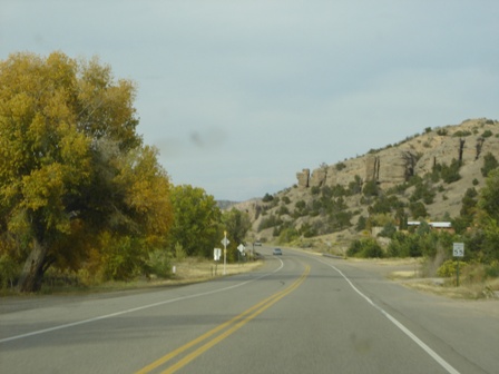
Carlsbad Caverns NP. Since the trip had been going too perfectly, we were ready for some kind of set back. We were NOT, however, ready for what happened next. Some big mean RV threw a rock up at our new windshield and gave us our first blemish in the new vehicle! This just weeks after replacing the windshield in the car which had been cracked and running for 2.5 years! Well, God showed us again that He has things planned out far in advance, and later that afternoon we found a cool guy at a shop in town that took less that 20min to fill the chip. Amen.

Oh, and while the chip was being fixed, we crossed the street and got a smoothie at the NazzBarr with free WiFi and made a new friend who promised to read our blog. Are you out there???

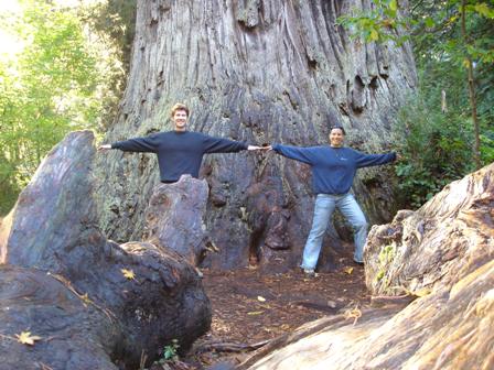
Carlsbad Caverns is a cave, a really, really big cave. But, no one knows how big, as only about 30 miles of it have been explored. We explored the tourist sections of the cave and ate lunch in the Big Room, which is underneath of 750 of solid rock! We walked from the surface down to the Big Room, explored a bit more, then took the elevator back up. We were both thankful for the elevator!

At sunset, we returned to the opening of the cave to watch the bat flight. Including the migrating bats, there were between 325,000-400,000 Mexican free-tail bats that flew out the cave at sunset to begin devouring half their body weight in insects! The average speed of a bat is 25mph, but they can get up to 60mph with a good tail wind. The sound of their wings was something like a gentle rain. Their exodus from the cave lasted well over 45min. That's pretty batty!